
Landscape and settlements
The beautiful rolling hills, wooded valleys and villages of the Chilterns have been shaped by both natural means and by humans over many centuries
The landscapes that make up this area have been shaped by both natural means – geology, weather and animals – and by humans over many centuries through farming, extraction, industrialisation and management. The resulting natural beauty, distinctive landscape and settlement types are special qualities that you may wish to feature in your Neighbourhood Plans as you look to protect and enhance your local area. The main points to consider about landscape and settlements are listed below.
Special quality: Landscape and settlements
- Ancient routeways and sunken lanes
- Panoramic views
- Dramatic chalk escarpment
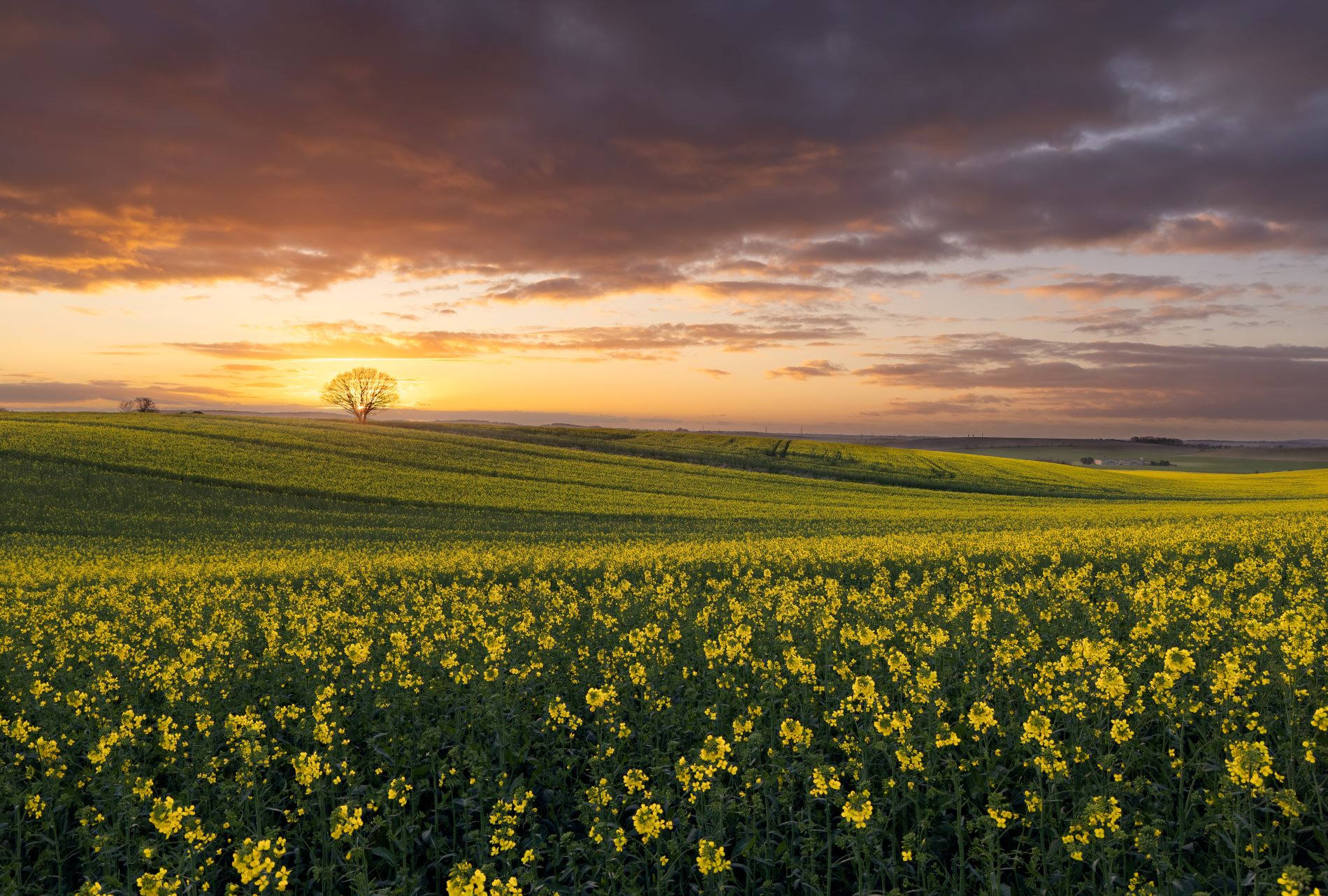
- Farmland
- Ancient hedgerows
- Hedgerows
- Field trees, orchards and parklands
- Common land and open access land

Understanding the landscape
Assessing what makes up a landscape is the first step in understanding the value it holds and its special qualities. Landscape assessments are produced at a range of scales, but two key types include National Character Areas (NCAs), and Landscape Character Assessments (or LCAs)
NCAs are undertaken by Natural England, the Government’s adviser for the natural environment are natural subdivisions of England based on a combination of landscape, biodiversity, geodiversity and economic activity. There are 159 NCAs and they follow natural, rather than administrative, boundaries.
LCAs are usually carried out by local authorities. LCA documents explain the unique combination of elements and features that make landscapes distinctive by mapping and describing character types and areas. They also show how the landscape is perceived, experienced and valued by people. LCAs can help us to understand what the landscape is like today, how it came about and how it may change in the future.
There is no single LCA for the Chilterns National Landscape. The area is covered by several county- and district-based LCAs that have been undertaken using similar (but not identical) methods. These assessments show that the Chilterns has four broad landscape types: Scarp Foothills and Vale Fringes; Chalk Scarp; Plateau and Dipslope; and River Valleys.
- Find out more about these areas and LCAs on the Chilterns National Landscape website.
Understanding previously published LCAs will help you to shape your vision for your area and your Neighbourhood Plan.
Understanding natural beauty
Discussions surrounding ‘natural beauty’ (which often includes human settlements and farmed landscapes) are often included in much detail in LCAs. Landscape itself is a combination of many things that interact – the geology of the area, the shape of the land (its topography), the habitats, and the built elements (settlements, villages, local building styles). Yet, the way you perceive or experience these features, sometimes called a ‘perceptual landscape’, is also very important. The wheel diagram here shows how all these elements can sit together to create what we consider to be a landscape of natural beauty.
The Landscape Institute, the professional body who represent landscape architects, definition of landscape is taken from the European Landscape Convention, ratified by the UK in 2006 (also called the Florence Convention):
‘an area, as perceived by people, the character of which is the result of the action and interaction of natural and/or human factors’.1
1Landscape Institute (2013) Guidelines for Landscape and Visual Impact Assessment Third Edition. London: The Landscape Institute and Institute of Environmental Management & Assessment.
To give protected status to a landscape you must appreciate what people value and how this can be delivered by the planning system. For more on this aspect of landscape definitions and protection please see the Florence Convention.

Principal landscape types of the Chilterns
Four principal landscape types make up the Chilterns. Each includes its own landscape character areas as sub-sets of the overall character type.
- Scarp Foothills and Vale Fringes – gently undulating chalk slopes with chalk springs between the base of the scarp and the clay vale to the west, including land mainly managed within intensive agriculture, large fields and relatively few hedgerows.
- Chalk Scarp – A ‘spine’ that runs roughly north-east to south-west along the western side of the National Landscape. A spectacular ridge rises high above the vale to the west and dominates views over a wide area. Combes and prominent hills form a deeply convoluted and steep edge that supports a mosaic of chalk grassland, woodland, scrub and parkland.
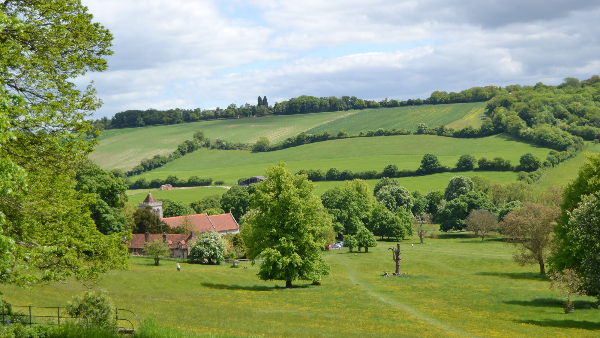
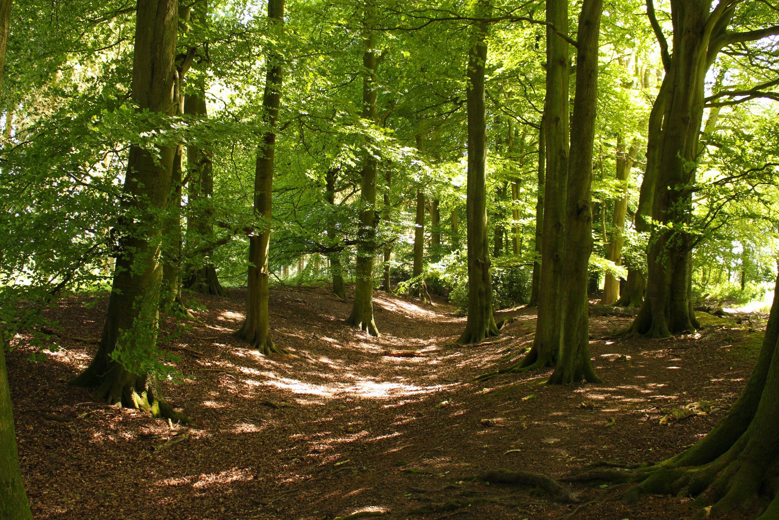
- Plateau and Dipslope – This forms a key part of the classic Chilterns landscape. Areas of the plateau are dissected by long, narrow and often dry valleys, and views are broken by extensive woodlands. Here, a deep sense of history and tranquillity can be found as much of the landscape has remained unchanged since medieval times.
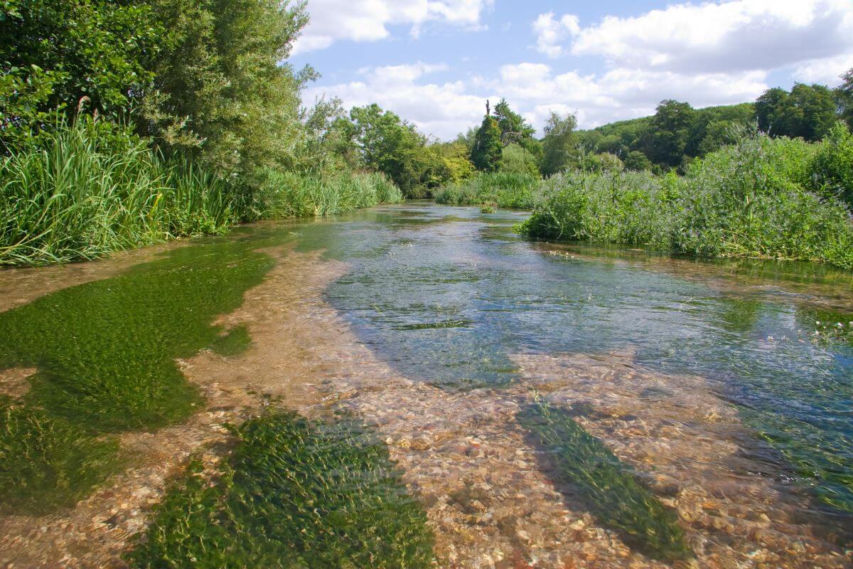
- River Valleys – The Chilterns contains a series of larger river valleys that cut through the scarp and dipslope. As natural corridors through the Chilterns, there is a long history of settlement and travel in the valleys.
Principal settlement types of the Chilterns
There are four principal settlement types in the Chilterns. These are also described in the Chilterns Buildings Design Guide.
- Valley bottom and scarpfoot villages (nucleated form) – Most villages that lie at the foot of the escarpment or in the valley bottoms share similar characteristics. These include an obvious centre to the village, a relatively compact layout – restricted by rising valley sides – and a backdrop of woodland and valley landscapes.
- Ridgetop villages (loose linear form) – Ridgetop and plateau villages show many similar characteristics, including a usually linear form with a prominent main street, and adjacent common land. Woodland, hedgerows and topography generally hide the village from its surrounding area.
- Plateau villages (mainly linear) – Ridgetop villages are mainly linear, with a prominent main street, and adjacent common land. Woodland, hedgerows and topography generally hide the village from its surrounding area.
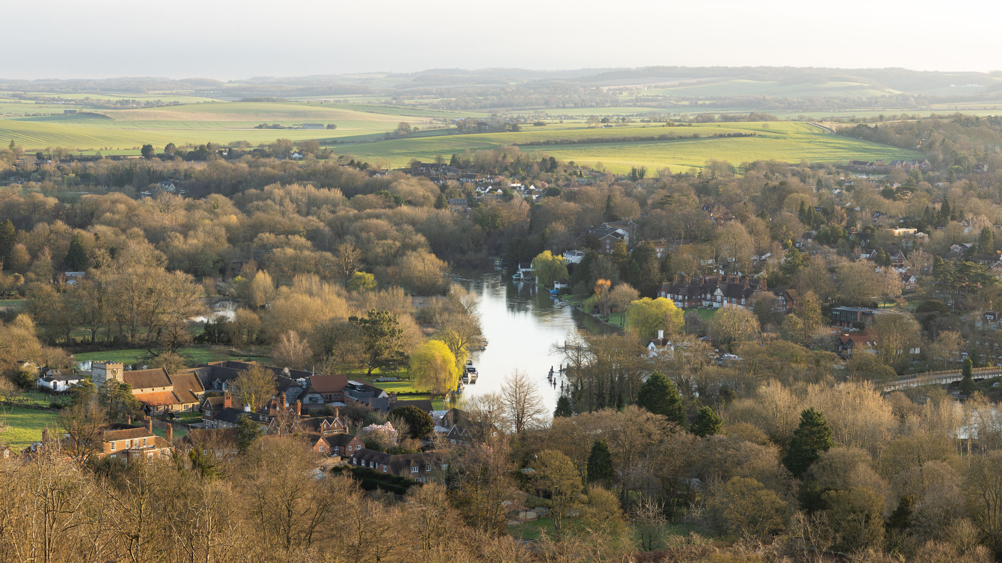
- Thames-side villages (river is a dominant natural and historic feature) – In these villages, the river is the dominant natural and historic feature, while the settlements are often small and relatively compact with strong historic traditions and buildings orientated towards the water.
Using LCAs in the Neighbourhood Planning process
Looking at the Chilterns by both Landscape Character Type (produced by Natural England) and Landscape Character Area (produced by local authorities), the largest landscape character area within the national Landscape is the Plateau and Dipslope. Together with the Chalk Scarp, this covers most of the Chilterns. This Central Chilterns landscape is often seen as a ‘classic’ Chilterns landscape – tranquil, timeless and with high horizons and a dark skies environment.
Within the Chilterns, various parts knit together to compose the overall character type – a mosaic of different land uses and habitats, including woodland, chalk grassland, common land, arable farmland, pastoral farmland, and parkland. River valleys and dry valley landscapes add further texture, along with hedgerows, field patterns and archaeological features. These overlapping landscape features combine to make up a sublime landscape – a matter of perception, of course.
In your Neighbourhood Plan, you may want to refer to these landscape types and landscape areas. You may want to discuss these elements, as they apply to you and promote their protection, conservation and enhancement.

Next steps
View our assessment criteria, checklist and supporting documentation to help you consider landscape and settlements within your Neighbourhood Planning processes.
Our Chilterns Neighbourhood Planning Toolkit was created as part of the Chalk, Cherries and Chairs Landscape Partnership Scheme, made possible with funding from the National Lottery Heritage Fund.
Published by the Chilterns Conservation Board (CCB), a Conservation Board established under the Countryside and Rights of Way Act 2000.
DISCLAIMER: While every effort is made to ensure all the legal and policy references are correct, CCB always recommends that these are checked as revisions and updates will occur.

What's on
Influencing planning and development
